Kellen Smetana
Nearly 150 years ago, several prominent American financiers commissioned artists and photographers to join geologic expeditions to this region of the country to help promote the American west. Over the last week, we saw first-hand in the jaw dropping scenery why the images they returned with led to the creation of the world’s first national park (Yellowstone, 1872). Simply marvelous landscape: I’ll try to keep the prose light and photos heavy.
Nearly 150 years ago, several prominent American financiers commissioned artists and photographers to join geologic expeditions to this region of the country to help promote the American west. Over the last week, we saw first-hand in the jaw dropping scenery why the images they returned with led to the creation of the world’s first national park (Yellowstone, 1872). Simply marvelous landscape: I’ll try to keep the prose light and photos heavy.
The Northern Tier cycling route, which Cory and I had been following since Minneapolis, rises north in Montana to hug the Canadian border as it passes through Glacier National Park and northern Idaho en route to the Pacific. Had we followed this route, we may actually already be close to completing our cross-country journey. In planning our ride, however, we found that our friend Theo could join us later in August and decided to build in a detour south to accommodate. That proved to be the spark for a route that took on a life of its own. The more we plotted and discussed our ride, the more excited we both became for this segment: it was time for some real mountains!
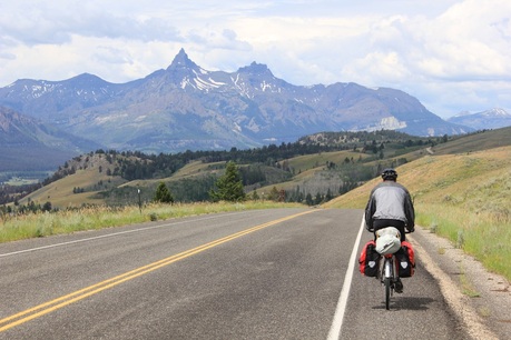
The first major component of our ascending journey was the Beartooth Highway, a 65 mile national scenic byway crisscrossing the alpine Montana-Wyoming border. We first heard of this epic road from a fellow cyclist at a gas station in North Dakota; he heralded it as one of the greatest climbs in America. Of course, with superlatives like that, we weaved it into our own route. We had been slowly climbing since about Bismark and had caught our first sight of the Beartooth Range pulling into Billings, but now it was time to hit the mountains for real. After a wonderful sejour with our hosts in Billings, we had a late, speedy day along a gradual uphill to set us up for an ascent of Beartooth Pass the next day.
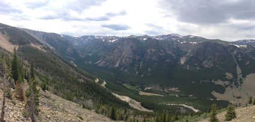
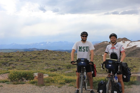
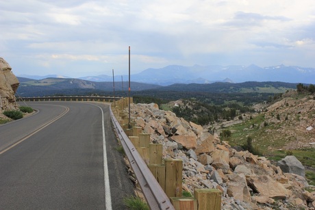
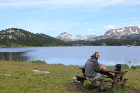
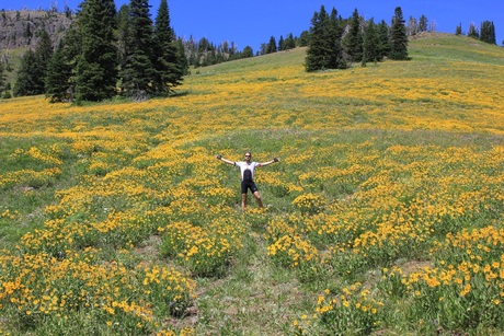
The next morning we sped across the remainder of the gradual uphill to Red Lodge before the road bent further up like a launching pad skyward. From there, it was a seven hour ascent to the top of Beartooth Pass: we climbed over 6,000 feet to reach the 10,947 foot pass, almost certainly our highest elevation of the entire trip. It was a hot climb, but a smattering of cheers from passing motorists made us feel a bit like we were climbing in the Tour de France, only with less agility and a lot more baggage. By 5pm we were over the top and bounding down into an absolute playland of natural beauty on the western side.
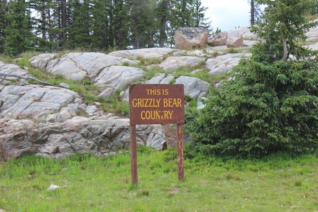
We elected to sleep high up in the mountains that evening; it was a great decision, even though an incessant rain moved in late evening and brought overnight temperatures down into the 30s. As we are now deep in bear country, our stealth camping is on hold in favor of established campsites, with bear boxes for storing food overnight and plenty of information on local activity. We even picked up a can of bear spray in Billings: a worthy weapon that blasts 30 feet of pepper spray toward any overly aggressive furry intruder. I’m happy to report zero incidences so far.
The next morning, wet and cold but with high spirits we set off along the western end of the highway. The camera was flying as we passed under high pines and jagged peaks. Pulling into Cooke City, Montana, our ride across the scenic Beartooth Highway came to an end. Four miles further down the road crossed into Yellowstone National Park. It was time to see what all the fuss was about.
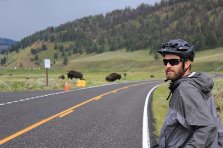
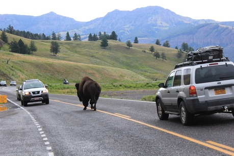
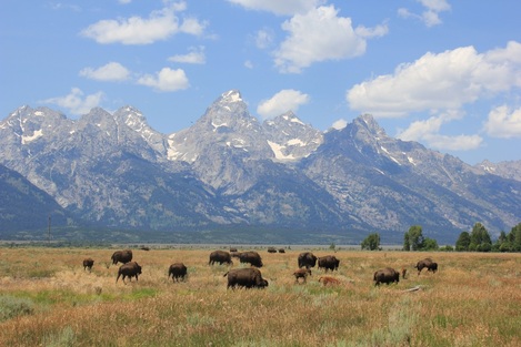
For some reason, I had categorized all my pieces of information about the park over the years into a simple representative summation: Old Faithful geyser. Boy, was I wrong! We spent nearly four days in the park, and my favorite part was actually the deep valleys of the north. Nearly as soon as we entered from Cooke City in the northeast, we were greeted by a herd of over 1,500 bison. Quite a sight to see! Not to mention, the 2,000 pound beast can also raise the heart rate of any cyclist when any one (or usually many) of them defiantly plods a path directly on the road in front of you. At one point we had to use a camper as a blocker as we passed one hairy gatekeeper in the middle of the road. Just awesome.
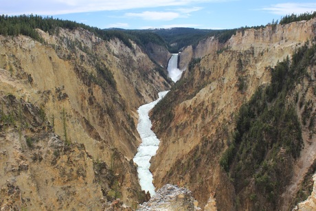
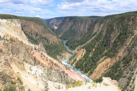
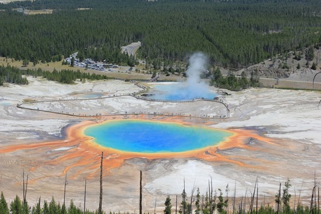
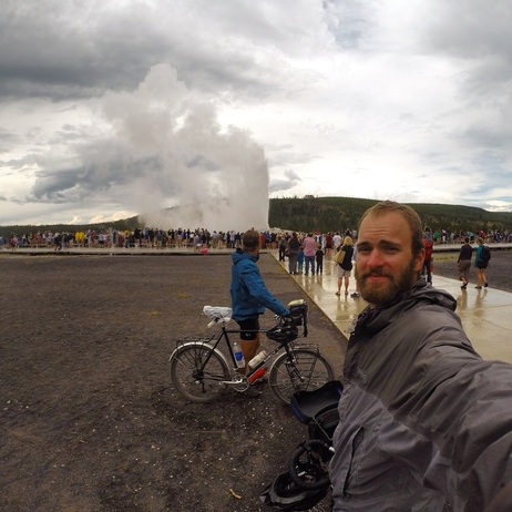
We spent an evening in the northern end of the park and caught an interesting Park Ranger Talk about the return of wolves to the territory; the next day, we were down into the heart of the park. I say “heart,” because much of the park’s unique geologic formations revolve around the grand Yellowstone caldera, the still active remnants of a roughly 40 mile diameter supervolcano that sits poised to blow big again sometime in the next 100,000 years. Much of the park’s scenery – the geysers, hot springs, deep canyons, mountainous ridgelines – are a result of this geologic feature. We first enjoyed the stunning formations in the deep canyon and falls of the Yellowstone River. The next day, we picked up over to the western end of the park to visit a more barren land of geysers, cauldrons, and hot springs. To get to Old Faithful and back we crossed the Great Continental Divide (Atlantic-Pacific) four times; it looks to be the first of many crossings – I may keep a tally. The geysers were cool; even better, however, was the eerie watchful eye of Grand Prismatic Spring.
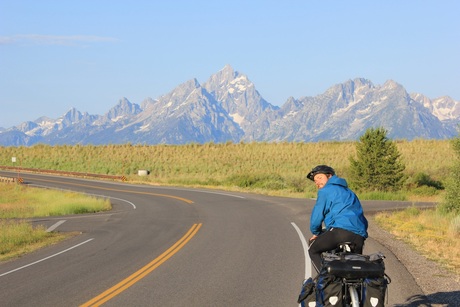
Yellowstone definitely exceeded expectations. The environment was beautiful, and we shared campsites with plenty of other friendly, interesting hikers and bikers from Iceland to New Zealand to Idaho. There was only one negative element to the park: traffic. The park has no shoulders, mountainous roads, and ornery vacationers hustling about for wildlife – a perfect storm for the weary cyclist. In fact, Yellowstone had, unfortunately, the worst drivers on the whole 3,600 mile trip so far from Boston; we even received a couple lovely profane-laced jeers from passing drivers (a bit different than the encouraging cheers from Beartooth…). I just smiled and waved at the passing simpletons, twisting whatever few points I could into their certainly already intolerable blood pressure levels… haha. Alas, the roads and traffic improved significantly as we pedaled south through the Tetons, including some newly paved bike trails.
After our meandering tour of Yellowstone, we cross the Great Continental Divide a fifth time (our legs appear to have strengthened since we left Boston…) and bound down south into the unmistakable Tetons. I doubted it could get much better than the idyllic Beartooth high valley and Yellowstone’s geologic wonders, but mon dieu! Grand Teton National Park was a great cap to the week.
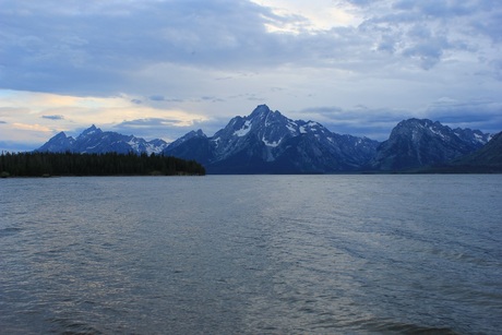
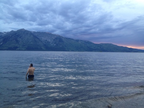
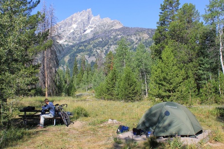
Coming down into the valley east of the Tetons (much of which is known as Jackson Hole), we spent the first night alongside calm Jackson Lake. Ten million years ago, tectonic movement on the Teton fault caused the western plate to rise while the eastern valley floor simultaneously dropped, a displacement of some 30,000 feet. Over time glacial erosion crafted the magnificent mountains we find today. The amazing thing about the Tetons is that because the valley is so low and flat, we are treated with an unhindered view of the mountains in all their glory, touching down to the lakes of the valley below like giant sentinels. Our first evening in the park, we went for a short hike and grabbed a refreshing swim in the lake.
Coming down into the valley east of the Tetons (much of which is known as Jackson Hole), we spent the first night alongside calm Jackson Lake. Ten million years ago, tectonic movement on the Teton fault caused the western plate to rise while the eastern valley floor simultaneously dropped, a displacement of some 30,000 feet. Over time glacial erosion crafted the magnificent mountains we find today. The amazing thing about the Tetons is that because the valley is so low and flat, we are treated with an unhindered view of the mountains in all their glory, touching down to the lakes of the valley below like giant sentinels. Our first evening in the park, we went for a short hike and grabbed a refreshing swim in the lake.
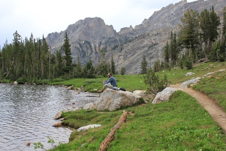
The next morning, we were up riding by 7am, pedaling down to vividly clear Jenny Lake. The ride was only 20 miles, but I think we took more photos than any full day previous to that. Locking in an excellent campsite near the lake, we fit in a 12 mile hike that afternoon up Paintbrush Canyon to Holly Lake, sitting high between two of the Tetons.
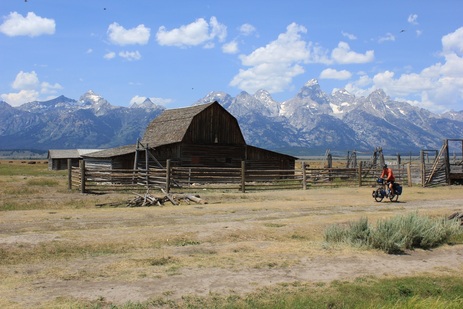
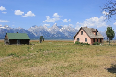
Instead of resting in Jackson, we decided to spend one more day in the park. We biked to Mormon Row – remnants of historic settlement in the valley, passed by Ansel Adams famed lookouts, and read alongside Jenny Lake. The camera was flying yet again.
Travelers on the great open road, it’s always time to keep moving on. Finally we rode downhill further into our most southerly point on the trip: Jackson, WY. It was another wet morning, but we were treated with a bike path all the way down into the city. Upon recommendation of another cyclist we met on the road, we decided to check out the National Museum of Wildlife Art on the way into town. Cory and I spent over two hours there, soaking up hundreds of years of art depicting the animal cousins we just spent a week pedaling alongside; it was a really great museum. At 3pm, we finally cruised into Jackson. Having only eaten two granola bars and some pretzels on the day, we instinctively found a Chinese buffet and ate until we were sick (no joke, I left half a cookie on the table because I literally could not finish it). We were back into cell service and civilization for the day. Later today, we will be back in the saddle and up over the daunting Teton Pass into Idaho. More mountains await.
 RSS Feed